Cootes to Escarpment EcoPark System partners and neighbouring landowners are working together to identify and improve ecological corridors in one of Canada’s most biodiverse and urbanized regions.
This page is a knowledge hub for near-urban ecological connectivity. Learn about EcoPark System partner-led projects that are creating safe wildlife passages and habitats, understand how our efforts contribute to ecological connectivity across Southern Ontario, and explore resources and case studies from across the globe.
Ecological Connectivity
No one wants to see wildlife unable to cross a highway to get to a wetland or migrating birds with no trees to rest in along their flight.
Ecological corridors support the movement of species between a park and surrounding natural areas, allowing them to interact and find habitat. They also allow other natural processes, like pollination, to occur across the broader landscape while giving people the opportunity to responsibly develop liveable communities that co-exist with nature and give it the best chance to thrive.
“A clearly defined geographical space where governance, management, and stewardship over the long term maintain or restore effective ecological connectivity while upholding Indigenous stewardship values”
the Canadian Council on Ecological Areas published a policy brief and report on the governance models, legislative and policy contexts, capacity needs, and case studies for connectivity conservation programs in Canada
The Canadian Connectivity Toolbox contains resources (e.g., policies, guidance, best practices, case studies, analytical programs, etc.) to help all levels of government, land managers and landowners advance connectivity conservation throughout the country. This Toolbox focuses on resources that are relevant to Canada and provides links to other excellent sources of information.
Cootes to Escarpment EcoPark System
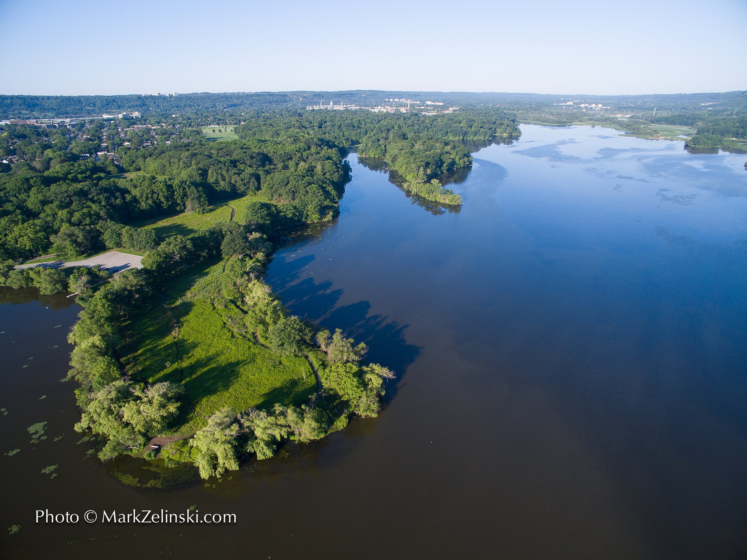
Cootes to Escarpment EcoPark System partner owned and neighbouring private lands fall within the last area without major infrastructure between Lake Ontario coastal wetlands to the Niagara Escarpment. This checker board of publicly and privately owned lands fall within Dundas Valley to Cootes Paradise Key Biodiversity Area, with several nature heritage core areas and linkages identified in the City of Hamilton and Halton Region's Official Plans. Studies conducted between 2021 and 2024 reveal a connected landscape within and between partner owned lands.

Partner owned properties fall within the Greenbelt and include Provincial Areas of Natural and Scientific Interest (ANSIs) like Cootes Paradise Marsh, and other federally and provincially recognized critical habitat. Nationally significant populations of American Columbo, Bashful Clubrush, Jefferson Salamander, and Blanding’s turtle call these lands home.

2022-2024 Cootes to Escarpment EcoPark System Pilot

The Cootes to Escarpment EcoPark System Ecological Corridor Pilot Program (ECP) enhanced biodiversity and mitigated the impacts of habitat fragmentation in Southern Ontario. Funded by Parks Canada, the fifteen-month pilot focused on improving ecological connectivity between protected lands in the cities of Hamilton and Burlington, one of the most biodiverse urban regions in Canada.
The ECP was guided by the principles of the National Program for Ecological Corridors (NPEC) and implemented by partners of the Cootes to Escarpment EcoPark System. These nine landowning government and non-government agencies designed and delivered 27 projects that restored habitat, reduced wildlife mortality, engaged landowners, and strengthened relationships with Indigenous communities. Key achievements include:
Restoration of 241 ha through native planting and invasive species removal.
Installation of over 2,800 m of mitigation fencing and bird-friendly infrastructure.
Engagement of 1,411 community members through 102 outreach events.
Securement of 12 ha of land to improve corridor connectivity.
Three Indigenous-led TEK forums fostering cultural exchange and stewardship.
Improved ecological connectivity mapping of areas within and between EcoPark System partner owned lands.
The pilot demonstrated the effectiveness of a collaborative, landscape-scale approach to conservation in urbanizing areas. It highlighted the importance of flexible landowner engagement, Indigenous knowledge integration, and adaptive governance. The ECP sets a precedent for improving ecological connectivity in near-urban spaces, offering a replicable model for integrated conservation planning that balances ecological, cultural, and community values. Continued collaboration and strategic investment will be essential to sustaining and scaling these efforts for long-term biodiversity protection.
Near-Urban Spaces in the Greater Golden Horseshoe
Nature is not just in remote places. It is right here, all around us. The Greater Golden Horseshoe (GGH) region has some of the most ecologically important areas in Canada, which provide essential ecosystem services to 70% of Ontarians, several First Nation Communities, and 10 million residents. It includes large and fast-growing cities like Hamilton, Kitchener, Guelph and Barrie, and the west side of Toronto, the most densely populated urban area in Canada.
Supporting nature includes implementing policy and creating infrastructure in and around cities that allow animals and plants to thrive, instead of cutting them off from habitat. There are ecologically important areas within and around the roughly 30% of natural cover that remains in the GGH. This includes the 7,000 km2 Greenbelt, a legislative effort to conserve connectivity near urbanized areas. The Greenbelt protects natural heritage and water resource systems that stretch across public, private, and agricultural lands, and into cities through urban river valleys, including portions of the Niagara Escarpment. A UNESCO Biosphere Reserve, the Niagara Escarpment is a long narrow geological feature that provides important pathways for species migrating with the changing climate.
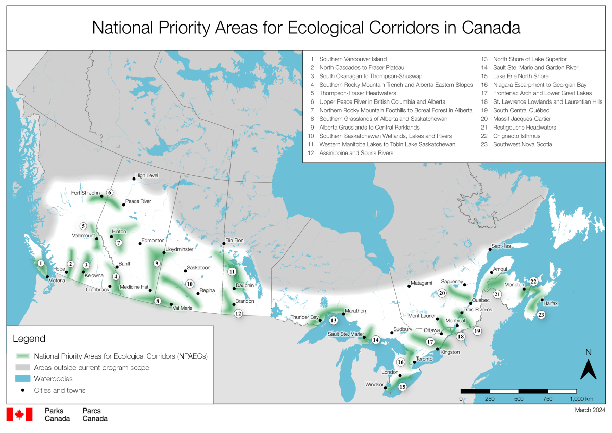
Parks Canada has identified portions of the Escarpment and Greenbelt as being a part of the “Niagara Escarpment to Georgian Bay” National Priority Area for Ecological Corridors. Starting at the western tip of Lake Ontario in the City of Hamilton, the priority area extends northwest to the town of Collingwood and wraps around Georgian Bay to Parry Sound.
Biodiversity within the “Niagara Escarpment to Georgian Bay” Priority Area has been subject to intense urban, recreational and agricultural development pressures. A network of transportation and utility corridors including railways, roads and highways bisect this area contributing to landscape fragmentation. Remaining habitats are at risk of further fragmentation and loss from continued development. Climate connectivity models indicate this priority area is a significant climate corridor for wildlife in southern Ontario due to the north-south alignment of the Escarpment. Wildlife shifting their ranges north to find suitable habitats because of climate change may rely on climate corridors in this priority area.